Drones are transforming the way businesses inspect infrastructure, measure land, and monitor large areas. From examining wind turbines and bridges to creating detailed construction maps and supporting security operations, commercial drones are becoming valuable tools across many industries.
However, not all drones are designed to perform the same job.
Inspection drones vs survey drones vs surveillance drones is an important comparison for engineers, surveyors, construction professionals, security teams, and anyone interested in commercial drone technology. Although these drones may share similar hardware, their primary purposes, sensors, software, and data outputs can be very different.
Inspection drones help identify potential defects. Survey drones collect accurate spatial data to create maps and 3D models. Surveillance drones observe areas and transmit video to support monitoring and situational awareness.
In this guide, we will explain how each type works, compare its technology and applications, explore the main differences, and help you choose the right drone for your needs.
Want to understand the difference between inspection drones, survey drones, and surveillance drones? Watch our quick video to discover how these three types of drones work, what makes them different, and where each type is used.
▶️ Watch the video:
Continue reading to explore their cameras, sensors, mapping capabilities, applications, and key differences.
What Is an Inspection Drone?
An inspection drone is an unmanned aircraft designed to examine structures, equipment, and infrastructure that may be difficult, expensive, or dangerous to inspect manually.
These drones are commonly used in industries such as energy, construction, utilities, manufacturing, and infrastructure maintenance.
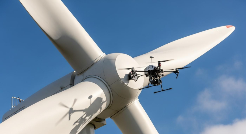
Instead of sending a worker to climb a wind turbine or access a difficult-to-reach structure, an inspection team can use a drone to capture detailed images and video from suitable viewing angles.
How Do Inspection Drones Work?
Inspection drones typically use a stabilized camera system to capture close-up images and video of a target structure. Depending on the mission, they may also carry specialized sensors.
For example, a drone inspecting a bridge can capture detailed images of concrete surfaces, joints, and other accessible components. Engineers can review the footage to identify areas that may require closer examination.
The drone itself does not automatically confirm that a structure is safe. Qualified professionals must interpret the collected information and determine whether further testing or maintenance is necessary.
Common Inspection Drone Sensors
- High-resolution cameras: Capture detailed images of surfaces, equipment, and structural components.
- Optical zoom cameras: Allow operators to examine distant targets without moving the drone too close.
- Thermal imaging cameras: Detect surface temperature differences that may indicate overheating, insulation problems, or other issues requiring investigation.
- Specialized sensors: Depending on the application, additional payloads can collect data for specific industrial inspection tasks.
Where Are Inspection Drones Used?
Inspection drones are used for examining wind turbines, bridges, power lines, solar farms, industrial facilities, rooftops, and other infrastructure.
For example, a thermal-equipped drone may help technicians identify an unusual hot spot on electrical equipment. The finding can guide a more detailed inspection, but it does not automatically establish the cause of the problem.
Best suited for: Examining equipment and structures, identifying potential defects, documenting asset condition, and supporting maintenance planning.
What Is a Survey Drone?
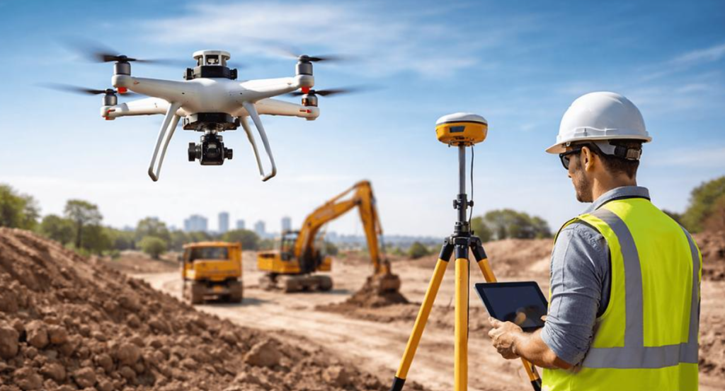
A survey drone, also called a mapping drone in many applications, is designed to collect geographic and spatial information about land, buildings, construction sites, and other areas.
Survey drones are particularly useful in surveying, civil engineering, mining, agriculture, land development, and construction.
Unlike an inspection drone, which focuses primarily on the condition of a target, a survey drone focuses on the location, shape, elevation, dimensions, and spatial relationships of objects or terrain.
How Do Survey Drones Work?
Survey drones capture aerial images or other spatial measurements according to a planned flight path.
When photogrammetry is used, specialized software processes overlapping photographs to reconstruct surfaces and generate outputs such as orthomosaic maps, point clouds, and 3D models.
Some survey drones also use RTK or PPK positioning workflows to improve the accuracy of image locations. GNSS provides satellite-based positioning, while RTK and PPK use correction techniques to improve positioning accuracy under suitable conditions.
The final accuracy depends on several factors, including the drone, sensor quality, positioning method, flight planning, ground control, processing workflow, and environmental conditions.
A drone map should not automatically be treated as survey-grade simply because the aircraft has an RTK receiver. Professional projects may require ground control, independent checkpoints, appropriate processing, and verification by a qualified surveyor.
Common Survey Drone Technologies
- Photogrammetry cameras: Capture overlapping aerial photographs for mapping and 3D reconstruction.
- RTK and PPK positioning: Improve the positioning of captured images when used with a suitable workflow.
- GNSS receivers: Provide satellite-based positioning data.
- LiDAR sensors: Use laser measurements to collect 3D information about surfaces and objects.
- Mapping software: Processes collected data into maps, elevation models, point clouds, and 3D representations.
Not every survey drone includes all these technologies. The right equipment depends on the project’s accuracy requirements, terrain, vegetation, budget, and deliverables.
Where Are Survey Drones Used?
Survey drones are widely used for construction progress mapping, land surveying, topographic mapping, mining volume calculations, road planning, agriculture, and site documentation.
For example, a construction company may use repeated drone surveys to compare site conditions over time, estimate earthwork volumes, and document progress.
Best suited for: Measuring and mapping land, generating spatial data, monitoring construction progress, and creating 2D or 3D site models.
What Is a Surveillance Drone?
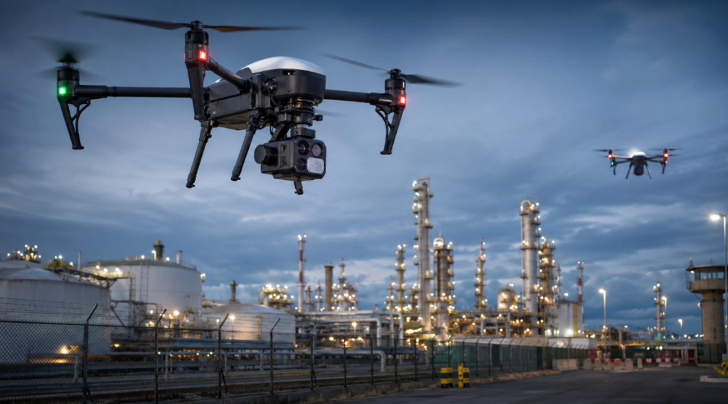
A surveillance drone is designed to observe an area and provide visual information to an operator or monitoring team. Its purpose is to improve situational awareness rather than primarily to measure land or examine a structure for defects.
Surveillance drones are used in facility security, infrastructure monitoring, emergency response, search operations, and certain public safety applications, subject to applicable laws and privacy requirements.
How Do Surveillance Drones Work?
A surveillance drone typically carries a camera system that sends live or recorded imagery to a ground station, control device, or monitoring system.
Operators can use the video feed to observe activity, check large areas, and assess developing situations. Depending on the aircraft and mission, a surveillance drone may follow a planned route, hover over a location, or be controlled remotely by an operator.
Some models include automated flight features, object tracking, or thermal imaging. These capabilities vary considerably, and automated detection should not be assumed to be perfectly accurate.
Common Surveillance Drone Technologies
- Stabilized cameras: Provide steady aerial video while the aircraft is moving.
- Optical zoom: Helps operators observe distant objects.
- Thermal imaging: Displays temperature differences that may be useful in certain low-visibility or search scenarios.
- Live video transmission: Sends imagery to an operator or monitoring station.
- Automated flight and tracking features: Help support repeatable routes or selected monitoring tasks on compatible systems.
Where Are Surveillance Drones Used?
Surveillance drones can support industrial perimeter monitoring, large-site security, emergency assessment, search-and-rescue operations, and observation of remote infrastructure.
For example, a facility security team may use a drone to inspect a remote section of a perimeter fence without immediately sending personnel across the entire site.
Their use must comply with applicable aviation regulations, operating restrictions, privacy rules, and organizational security policies.
Best suited for: Observing activity, monitoring areas, providing live aerial video, and supporting situational awareness.
Inspection Drones vs Survey Drones vs Surveillance Drones: Key Differences
The biggest difference between these three drone types is the question each one is designed to answer.
An inspection drone asks, “Is there a problem with this structure or piece of equipment?”
A survey drone asks, “What are the dimensions, shape, position, or elevation of this area?”
A surveillance drone asks, “What is happening in this area right now?”
The following table summarizes their primary differences.
| Feature | Inspection Drone | Survey Drone | Surveillance Drone |
|---|---|---|---|
| Primary purpose | Examine condition | Measure and map | Observe and monitor |
| Typical output | Inspection photos, video, thermal imagery | Maps, point clouds, measurements, 3D models | Live or recorded video |
| Common camera | High-resolution or zoom camera | Mapping camera or LiDAR payload | Stabilized zoom camera |
| Specialized sensors | Thermal, zoom, or application-specific sensors | RTK/GNSS, photogrammetry, LiDAR | Zoom, thermal, and video systems |
| Main users | Engineers and maintenance teams | Surveyors, civil engineers, construction teams | Security and monitoring teams |
| Typical applications | Wind turbines, bridges, electrical equipment | Land surveys, construction sites, terrain mapping | Facility security, site monitoring, search operations |
| Main deliverable | Evidence of condition or possible defects | Spatial measurements and mapping data | Visual awareness of activity |
These are typical configurations rather than strict rules. One aircraft platform may support more than one mission when equipped with suitable sensors and software.
Camera and Sensor Differences
The camera and sensor package is often one of the most important differences between inspection, survey, and surveillance drones.
Inspection Drone Cameras
Inspection drones prioritize image detail and the ability to examine a particular object. A high-resolution camera helps capture surface features, while optical zoom may allow an operator to view a target from a safer distance.
Thermal cameras can provide additional information about temperature patterns. However, thermal images need to be interpreted carefully because environmental conditions, surface properties, and camera settings affect the readings.
Survey Drone Cameras
Survey drones prioritize reliable spatial data. Photogrammetry workflows generally require suitable image overlap, consistent capture conditions, and appropriate processing.
For some projects, RTK or PPK positioning can reduce reliance on extensive ground control, but it does not remove the need to validate accuracy where project requirements demand it.
LiDAR may be preferable for certain environments or mapping tasks, particularly when detailed three-dimensional measurements are needed. Equipment selection depends on the required deliverables and site conditions.
Surveillance Drone Cameras
Surveillance drones prioritize viewing coverage, stable video, and the ability to observe activity. Optical zoom can help operators examine distant areas, while thermal imaging may assist with certain search or monitoring tasks.
Live video transmission, battery endurance, communications reliability, and the ability to operate safely within permitted limits can be as important as camera resolution.
Accuracy, Coverage, and Data Collection
Accuracy means different things for each drone category.
For an inspection drone, the priority may be capturing sufficiently detailed imagery to assess a crack or component. Image quality, viewing angle, lighting, and distance from the target all matter.
For a survey drone, accuracy may refer to horizontal positioning, elevation measurements, or the quality of the resulting map or model. Ground control, checkpoints, camera calibration, positioning systems, and processing methods can influence the result.
For a surveillance drone, the priority is often obtaining a useful and timely view of an area. Camera coverage, video clarity, transmission reliability, flight time, and operator awareness may matter more than survey-grade positioning accuracy.
There is no universal accuracy rating that applies to all three types. Requirements should be defined according to the mission and the data the user needs.
How Much Do Inspection, Survey, and Surveillance Drones Cost?
Drone prices vary widely according to payloads, flight endurance, software, positioning technology, durability, support, and other requirements. A simple aircraft and a complete professional drone system can have very different total costs.
| Cost factor | Inspection | Survey | Surveillance |
|---|---|---|---|
| Camera or sensor | Zoom or thermal payloads may add cost | Mapping cameras or LiDAR can add substantial cost | Zoom, thermal, and transmission systems may add cost |
| Software | Inspection and asset-management tools | Photogrammetry and mapping software | Video management and monitoring tools |
| Additional equipment | Inspection accessories and safety equipment | GNSS equipment, control points, processing hardware | Communications, charging, and monitoring equipment |
| Ongoing costs | Maintenance and inspection workflow | Data processing, software, and accuracy verification | Battery replacement, maintenance, and communications |
Rather than choosing a drone based only on its purchase price, calculate the total cost of the required system. Consider training, maintenance, batteries, software subscriptions, data processing, insurance where appropriate, and regulatory compliance.
For commercial projects, the best value is usually the system that meets the mission requirements reliably—not necessarily the drone with the most features.
Can One Drone Perform Inspection, Surveying, and Surveillance?
Yes, in some cases. A single aircraft platform can support multiple tasks if it is compatible with the required payloads, software, flight modes, and operating conditions.
For example, a commercial drone with a suitable zoom camera might be used for basic visual inspections and certain monitoring tasks. With a compatible mapping camera and an appropriate workflow, a platform may also be used for surveying.
However, not every drone can perform every task well. A compact camera drone may not provide the positioning, sensor compatibility, flight endurance, or data quality required for a professional survey. A drone optimized for mapping may not provide the zoom or thermal capabilities needed for a particular inspection.
Before choosing a multi-purpose platform, confirm payload compatibility, supported software, positioning capabilities, data requirements, and applicable operating rules.
Which Type of Drone Should You Choose?
Choose the drone according to the result you need.
Choose an inspection drone if:
- You need detailed images of infrastructure or equipment.
- You want to examine difficult-to-reach areas.
- You need thermal imagery or optical zoom for a specific inspection task.
- Your team needs visual documentation to support maintenance decisions.
Choose a survey drone if:
- You need maps, terrain measurements, or 3D models.
- You work in land surveying, construction, mining, or site development.
- Your project requires documented spatial accuracy.
- You have a suitable mapping and data-processing workflow.
Choose a surveillance drone if:
- You need live aerial video or repeated visual monitoring.
- You manage a large facility or remote site.
- You need to improve situational awareness during an authorized security or emergency operation.
- Your mission requires suitable video transmission, camera coverage, and operating endurance.
Before buying, write down the mission requirements, required data outputs, operating environment, flight duration, payload compatibility, training needs, and budget. This makes it easier to compare models fairly.
Frequently Asked Questions
1. What is the main difference between inspection drones and survey drones?
Inspection drones focus on examining the condition of structures and equipment, while survey drones collect spatial data to measure and map land, buildings, and terrain.
2. Are survey drones more accurate than regular drones?
Survey drones are typically configured for mapping and measurement workflows, but accuracy depends on the sensor, positioning method, flight planning, ground control, processing, and validation. A drone marketed for surveying is not automatically accurate enough for every professional project.
3. Do inspection drones use thermal cameras?
Some inspection drones use thermal cameras to detect temperature patterns that may indicate potential problems. Others rely on high-resolution visual cameras or optical zoom. The right sensor depends on what is being inspected.
4. What is a surveillance drone used for?
Surveillance drones provide aerial observation and live or recorded video. Common applications include authorized facility monitoring, security assessments, emergency response, and search operations.
5. Can a survey drone be used for inspection?
Sometimes. A survey drone may capture useful images of structures, but the camera, zoom capability, sensor quality, and viewing angles must be suitable for the inspection task. Detailed inspections may require a dedicated payload or aircraft.
6. What is the difference between RTK and GNSS in survey drones?
GNSS refers to satellite navigation systems used for positioning. RTK is a correction technique that can improve positioning accuracy by using reference data. RTK is not a separate satellite navigation system, and achieving the required mapping accuracy still depends on the complete workflow.
7. Are thermal drones useful for surveillance?
Thermal drones can help operators observe temperature differences in certain conditions, including some search and monitoring situations. Performance depends on the sensor, weather, distance, target characteristics, and operating conditions.
8. Which drone is best for construction projects?
It depends on the task. Inspection drones can help examine structures, survey drones can map terrain and document site progress, and surveillance drones can support authorized site monitoring. Some projects benefit from using more than one type of setup.
Final Verdict: Inspection vs Survey vs Surveillance Drones
Inspection drones, survey drones, and surveillance drones can look similar, but their primary missions are different.
- Inspection drones check: They capture detailed information about the condition of structures and equipment.
- Survey drones measure: They collect spatial data for mapping, measurements, and 3D models.
- Surveillance drones observe: They provide visual information to support monitoring and situational awareness.
The right drone depends on the job, the required data, and the sensors and software available. Understanding these differences helps you choose suitable equipment without paying for capabilities you do not need.
If you are exploring commercial drone technology, keep following RA Electronics for practical explanations of drones, electronics, sensors, and emerging technologies.
Have a question about inspection, survey, or surveillance drones? Share it in the comments and let us know which drone technology you would like us to explain next.